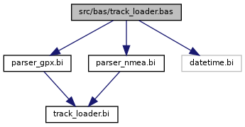
Source for loading MapFactor Navigator track files. More...

Go to the source code of this file.
Macros | |
| #define | EXTREM(_V_) |
| Macro to check extrema. More... | |
| #define | LOG2(_X_) |
| Macro computing the base 2 logarythm. More... | |
| #define | MIN(V1, V2) |
| Macro finding the minimum. More... | |
Functions | |
| FUNCTION_CDECL_ALIAS_AS_DOUBLE | atanh (BYVAL_AS_DOUBLE) |
| FUNCTION_CDECL_ALIAS_AS_DOUBLE | tanh (BYVAL_AS_DOUBLE) |
| FUNCTION_AS_LONG | lat2pixel (BYVAL_AS_float V, BYVAL_AS_LONG Z) |
| Transform world latitude to map Y-pixel. More... | |
| FUNCTION_AS_LONG | lon2pixel (BYVAL_AS_float V, BYVAL_AS_LONG Z) |
| Transform world longitude to map X-pixel. More... | |
| FUNCTION_AS_float | pixel2lon (BYVAL_AS_long Z, BYVAL_AS_LONG X) |
| Transform map X-pixel to world longitude. More... | |
| FUNCTION_AS_float | pixel2lat (BYVAL_AS_long Z, BYVAL_AS_LONG Y) |
| Transform map Y-pixel to world latitude. More... | |
| FUNCTION_CDECL_AS_LONG | latlon2zoom (BYVAL_AS_LONG W, BYVAL_AS_LONG H, BYVAL_AS_float La0, BYVAL_AS_float La1, BYVAL_AS_float Lo0, BYVAL_AS_float Lo1) |
| Evaluate the matching zoom level for BBox. More... | |
Variables | |
| const LONG | TILESIZE = 256 |
| size of tile used in osm_gps_map More... | |
| const LONG | TILESIZEd2 = 128 |
| half size More... | |
Source for loading MapFactor Navigator track files.
A UDT to load and analyse track files (*.NMEA and *.GPX) generated by the MapFactor Navigator software.
Definition in file track_loader.bas.
| #define EXTREM | ( | _V_ | ) |
Macro to check extrema.
This macro creates code to check a value in TrackLoader.V() against the extrema in TrackLoader.Mn and TrackLoader.Mx. Used at the end of a line (no code behind)!
Definition at line 29 of file track_loader.bas.
| #define LOG2 | ( | _X_ | ) |
Macro computing the base 2 logarythm.
Definition at line 97 of file track_loader.bas.
| #define MIN | ( | V1, | |
| V2 | |||
| ) |
Macro finding the minimum.
Definition at line 99 of file track_loader.bas.
| FUNCTION_CDECL_ALIAS_AS_DOUBLE atanh | ( | BYVAL_AS_DOUBLE | ) |
| FUNCTION_CDECL_ALIAS_AS_DOUBLE tanh | ( | BYVAL_AS_DOUBLE | ) |
| FUNCTION_AS_LONG lat2pixel | ( | BYVAL_AS_float | V, |
| BYVAL_AS_LONG | Z | ||
| ) |
Transform world latitude to map Y-pixel.
| V | Worlds latitude in radians |
| Z | Zoom level |
This function transforms from worlds latitude coordinate (in radians) to map widget Y pixels.
Definition at line 42 of file track_loader.bas.
| FUNCTION_AS_LONG lon2pixel | ( | BYVAL_AS_float | V, |
| BYVAL_AS_LONG | Z | ||
| ) |
Transform world longitude to map X-pixel.
| V | Worlds latitude in radians |
| Z | Zoom level |
This function transforms from worlds longitude coordinate (in radians) to map widget X pixels.
Definition at line 58 of file track_loader.bas.
| FUNCTION_AS_float pixel2lon | ( | BYVAL_AS_long | Z, |
| BYVAL_AS_LONG | X | ||
| ) |
Transform map X-pixel to world longitude.
| Z | Zoom level |
| X | Map x in pixel |
This function transforms from map widget X pixels to worlds longitude coordinate (in radians).
Definition at line 74 of file track_loader.bas.
| FUNCTION_AS_float pixel2lat | ( | BYVAL_AS_long | Z, |
| BYVAL_AS_LONG | Y | ||
| ) |
Transform map Y-pixel to world latitude.
| Z | Zoom level |
| Y | Map y in pixel |
This function transforms from map widget Y pixel to worlds latitude coordinate (in radians).
Definition at line 90 of file track_loader.bas.
| FUNCTION_CDECL_AS_LONG latlon2zoom | ( | BYVAL_AS_LONG | W, |
| BYVAL_AS_LONG | H, | ||
| BYVAL_AS_float | La0, | ||
| BYVAL_AS_float | La1, | ||
| BYVAL_AS_float | Lo0, | ||
| BYVAL_AS_float | Lo1 | ||
| ) |
Evaluate the matching zoom level for BBox.
| W | Width of map widget |
| H | Height of map widget |
| La0 | Minimum latitude |
| La1 | Maximum latitude |
| Lo0 | Minimum longitude |
| Lo1 | Maximum longitude |
This function evaluates the zoom level for the map in order to show a bounding box completely on the map.
Definition at line 116 of file track_loader.bas.

| const LONG TILESIZE = 256 |
size of tile used in osm_gps_map
Definition at line 13 of file track_loader.bas.
| const LONG TILESIZEd2 = 128 |
half size
Definition at line 14 of file track_loader.bas.