 |
pavi
0.0
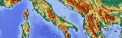
Map Path Viewer
|
|
Go to the documentation of this file.
22 ,
ERA = 3443.89849 * 1852
88 DECLARE CONSTRUCTOR(
BYVAL AS CONST ZSTRING PTR = 0)
90 DECLARE FUNCTION Dist(
BYVAL AS ULONG,
BYVAL AS ULONG)
AS DOUBLE
93 DECLARE FUNCTION Pixel(
BYVAL AS LONG,
BYVAL AS LONG,
BYVAL AS LONG)
AS BYTE
94 DECLARE FUNCTION SkipOut(
BYVAL Typ
AS LONG,
BYVAL Di
AS float)
AS LONG
95 DECLARE SUB MapCenter(
BYVAL W
AS LONG,
BYVAL H
AS LONG)
105 ,
BYVAL AS float)
AS LONG
TrackLoader(BYVAL_AS_CONST_ZSTRING_PTR)
CTOR loading track data.
FUNCTION_AS_LONG SkipOut(BYVAL_AS_LONG Typ, BYVAL_AS_float Di)
Compute exit of cloud.
FUNCTION_AS_BYTE Pixel(BYVAL_AS_LONG, BYVAL_AS_LONG, BYVAL_AS_LONG)
Compute pixel values for given center and zoom.
LONG CoZo
computed zoom level in map
const DOUBLE LN2
natural logarythm 2.0
ZSTRING_PTR Errr
error message
const DOUBLE NaN
Not a number (error value)
LONG Co_X
map-X for computed pixels
float Ang
Direction Angle.
LONG UsZo
users zoom level in map
UBYTE_PTR Buff
buffer for input, and (later) points array
Data for a single track point.
STRING Path
path in TVT tree store
LONG Xpix
world X pixel for ploting
const DOUBLE Rad2Deg
transform radians in degree
FUNCTION_AS_float Nearest(BYVAL_AS_float, BYVAL_AS_float)
Find point nearest to the given [radians] position.
float UsLo
users map center latitude (degree)
const DOUBLE ERA
earth radius [m]
float CoLa
computed map center longitude (degree)
FUNCTION_AS_LONG latlon2zoom(BYVAL_AS_LONG, BYVAL_AS_LONG, BYVAL_AS_float, BYVAL_AS_float, BYVAL_AS_float, BYVAL_AS_float)
Evaluate the matching zoom level for BBox.
const DOUBLE PI
PI = 3.14...
LONG Co_Y
map-Y for computed pixels
INTEGER Byt
bytes read from file (buffer length)
float Spd
Speed over ground [km/h].
SUB MapCenter(BYVAL_AS_LONG W, BYVAL_AS_LONG H)
Compute center and zoom to plot complete track.
FUNCTION_AS_DOUBLE Dist(BYVAL_AS_ULONG, BYVAL_AS_ULONG)
Compute distance between two points.
LONG Cur
last track position in map plot
INTEGER Siz
byte size of TrackLoader.V array
LONG Az
number of entries in array TrackLoader.V
float UsLa
users map center longitude (degree)
float CoLo
computed map center latitude (degree)
LONG Ypix
world Y pixel for ploting
PROPERTY_AS_float ASpd()
Compute the speed avarage.
PROPERTY_AS_float LTrk()
Compute track length.
UDT collecting and holding the track data.
const DOUBLE Deg2Rad
transform degree in radians


 1.8.17